Adirondacks Snowmobile App
Easiest way to navigate the Adirondack mountains from a snowmobile.
Project Overview
Snowmobilers in the Adirondacks needed access to an interactive trail map to better plan their outdoor riding adventures. The Adirondacks has one of the largest trail networks in New York state; many areas remote enough for a cellular signal to never reach. ROOST brought us in to create Adirondacks, USA, a snowmobile native app containing information about the trails, nearby gas stations, stores, restaurants and lodging properties that welcome sledders.
GOALS
Launch a native app available to snowmobilers and mountain enthusiasts.
Provide a downloadable interactive map experience so trails can be viewed offline.
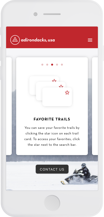
Search through interest points and add them to a favorites list.
CLIENT
Regional Office of Sustainable Tourism (ROOST)
ROLE
Digital Designer (UX research, Interaction design, Visual design, Creative direction, Client presentations)
TOOLS
Sketch, Adobe Premier, Zeplin
TEAM
Project Manager, Junior Designer, BE Developers, FE Developers
AGENCY
Genome Digital
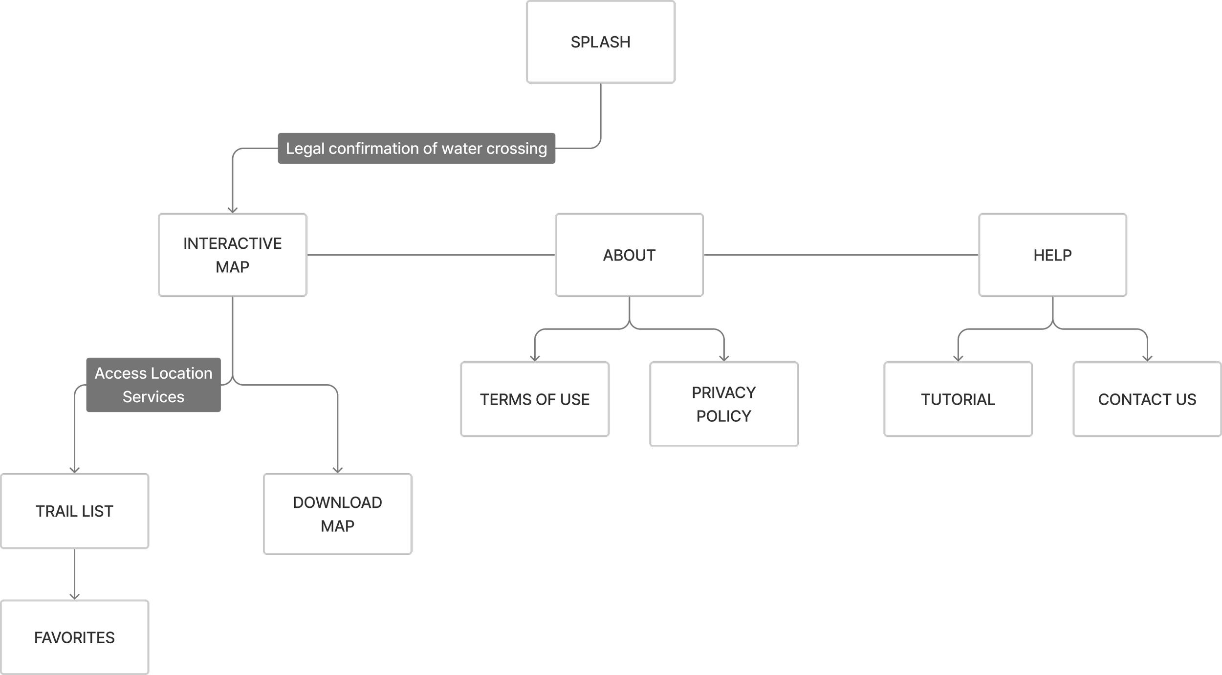
Site Map
The user will be spending most of their time exploring the interactive map and trails. The technology needed to allow for map exploration and offline use was called out early on in the site map. We ensured the users would be able to find their destinations before leaving cellular service areas.
Wireframes
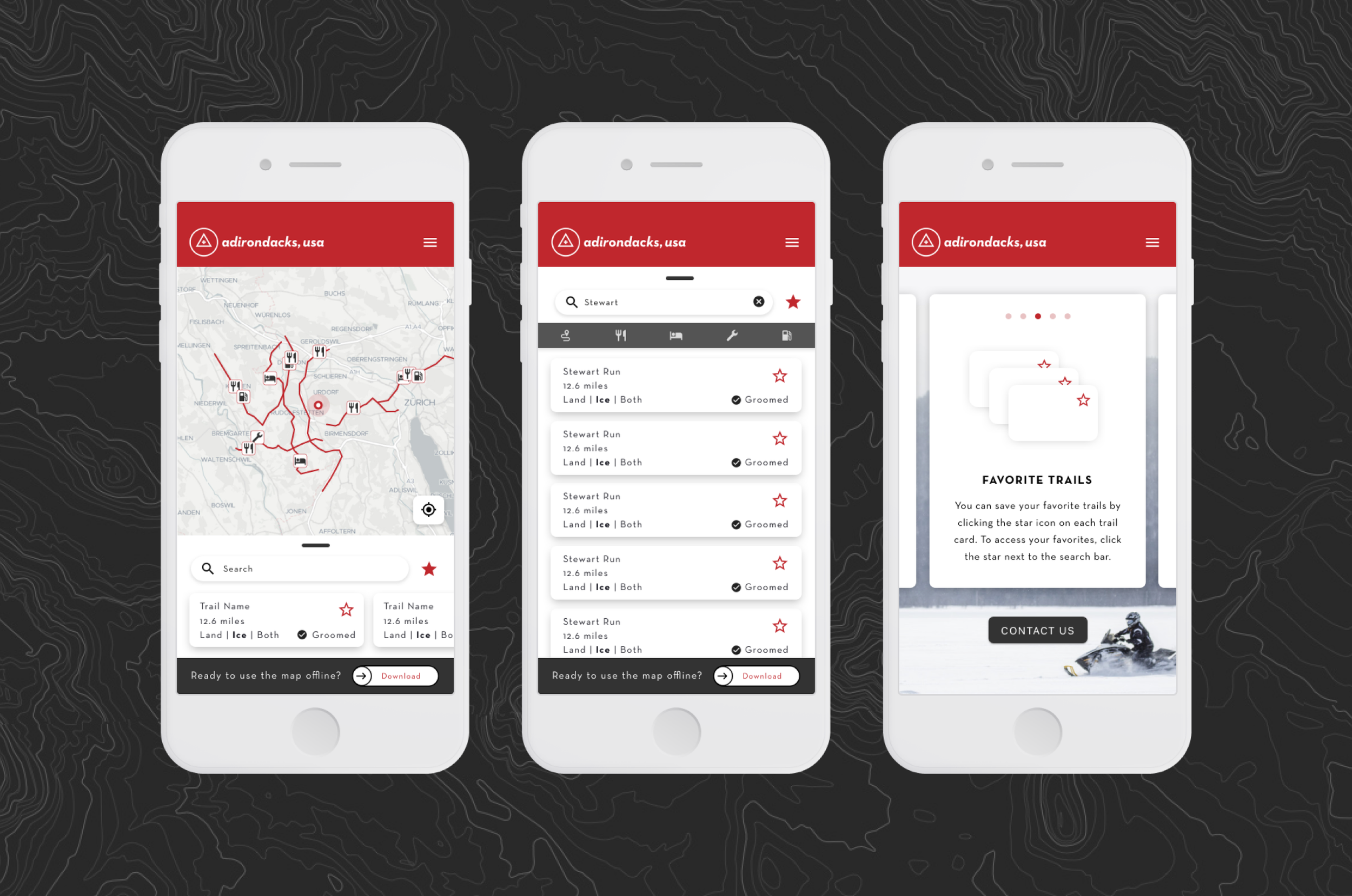
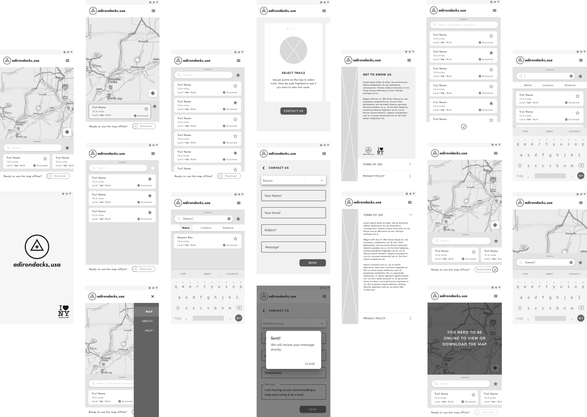
We produced high fidelity wireframes for this project due to the specificity of the trail and point of interest information. The interactive map needed to be accessible for on-the-go users. We added a horizontal scroll at the bottom of the map for nearby trails. Then a larger tray swipe action reveals the full list with category filters.
Interactive Map
The main touchpoint for users is the interactive map. They will spend the most time here exploring the nearby points of interest and trails. We used Mapbox’s API which allows us to add the proper customization for easy visibility to those features. Each trail and POI is visually shown on the map with iconography that can be tapped into to open a tooltip description.
Showing the user’s current location is helpful for when they are connected to data and can see what is nearby. Before heading into the mountains, the user can swipe on the bottom bar to download the map anytime. This allows sledders to continue to interact with the map and stay within marked areas.
The search functionality can narrow down the map content and only show certain trails matching the keywords.

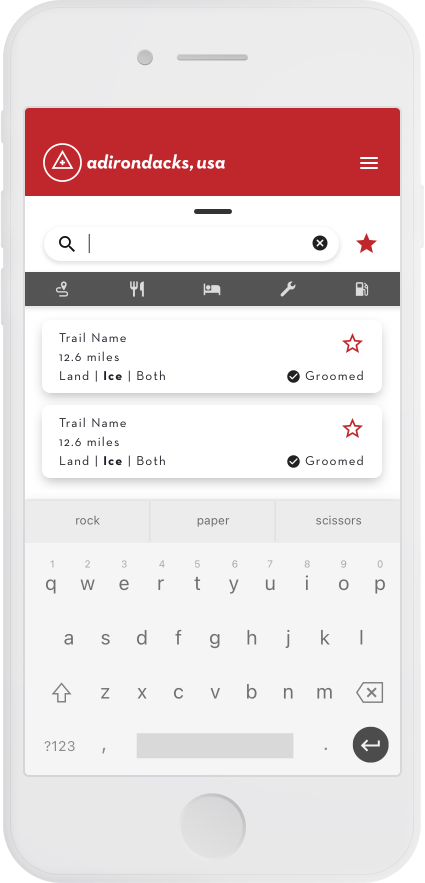
Trail Search
Categories are assigned to the map content so that items can easily be filtered during search.
Trails
Food
Lodging
Service
Gas
The trails category consists of marked trails from point A to point B and conditions. Snowmobilers will know whether they are traveling over land, ice or a mix of both during their ride. The remaining categories are single map coordinates. The Adirondacks trail system also offer groomed trails which can be desirable for certain users.

Help & Contact
We provided a short carousel tutorial to help users navigate the use of the app.
The client also requested a way for users to get in touch. A category based reason helps narrow down what the message is about with form field validations.